ACE calls for national digital catalogue of design codes and rule-checking tools
10 March 2026

AWW delivers projects across the nuclear, defence, commercial and public sectors, and frequently acts as lead consultant under traditional contract arrangements, often assuming full liability under professional indemnity insurance.
Maintaining up-to-date survey information, particularly on existing or part-demolished structures, had become time-intensive and costly for AWW, so it undertook a comprehensive market review to find a solution capable of capturing reliable, high-accuracy site data while accelerating its Revit modelling workflows.
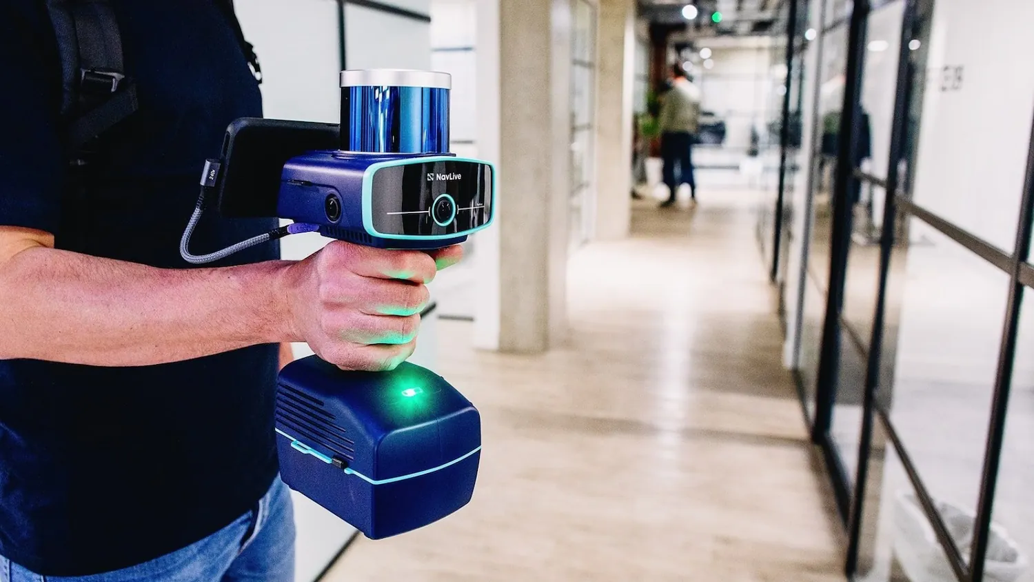
Ultimately, AWW selected the NavLive LiDAR BIM scanner as its preferred solution, as the system enables the company’s designers to generate highly detailed point cloud data within minutes.
Through NavLive’s software platform, AWW has produced Revit-ready outline models that correct, enhance and validate existing survey and planning information. The technology has been deployed across five separate buildings by staff at all levels, delivering consistent results and measurable gains in accuracy, speed and assurance, NavLive said.
Nicholas Mulholland, MD at AWW, added: “The NavLive scanner has significantly accelerated our design workflow and achieved measurable cost savings while improving the accuracy and assurance of our model data.”
NavLive was developed by academics in robotics research at the University of Oxford. Last summer, the startup secured £3.3m in seed funding. The technology is shortlisted twice in this year’s Digital Construction Awards.
Keep up to date with DC+: sign up for the midweek newsletter.